Pittsfield Historical Society’sPittsfield Municipal Airport |
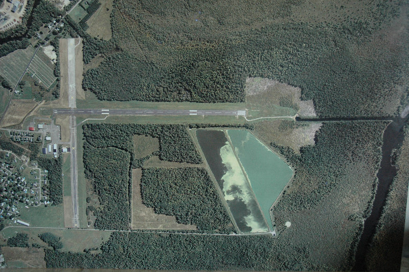 Aerial view of the Airport in 2006. Note seaplane access center right. |
|
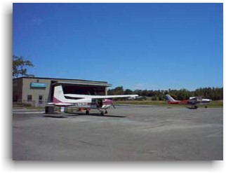
The airport began operations in the 1930’s with a 2000 by 100-foot north-south gravel runway (1-19) on a portion of land that was formerly used as the Town’s fairgrounds. With funding from a Civil Works Administration grant, this runway was extended and paved and a 4000 by 150-foot east-west paved runway (10-28) was constructed. Between 1940 and 1942, some terminal-area facilities were constructed. The U.S. Navy used the airport from 1942-44 as a training facility. A Federal Aid to Airports Program (FAAP) grant in 1959 facilitated pavement-strengthening projects for both runways. 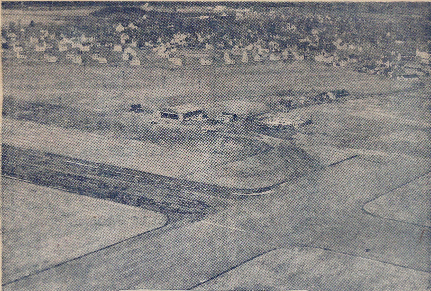 The airport in 1952. At right is a newspaper photo of the airport in 1952, with Peltoma Acres housing development in the background. In 1961, a private citizen leased the airport from the Town and became the first fixed base operator (FBO). By 1968, the airport was receiving scheduled airline service from Inland Air (owned by Guilford Woolen Co.), which provided round-trip service between Pittsfield and New York City. This service only lasted six months. During the 1970’s, additional hangers were constructed and new aircraft navigational aids (NAVAIDs) were installed at the airport. In 1979, Cianbro Corporation dredged an 1800-foot seaplane taxiway about 1100 feet south of runway 1-19 to the Sebasticook River. This created a public seaplane base, giving seaplane pilots access to fuel and maintenance facilities. Runway 10-28 was closed in 1985 due to low usage, short usable length, cost to maintain, and desire to retain trees within the runway visual zone (RVZ). 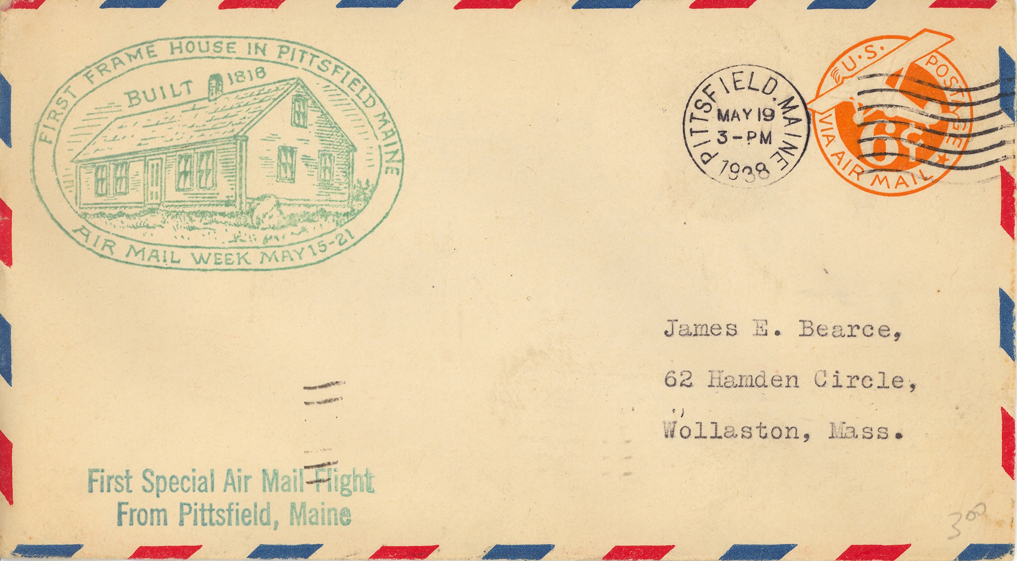 Envelope from first airmail flight from Pittsfield, 1938. Crosswinds are a limiting factor at the airport. Wind data extrapolated from Bangor International Airport suggest that the orientation of Runway 1-19 could be improved. Aircraft with wingspans of up to 49 feet are estimated to be able to take off and land in Pittsfield 92.9% of the time, which is less than the 95% level recommended by the Federal Aviation Administration. For larger planes with up to 79 foot wingspans, the airport is usable an estimated 96.3% of the time. The airport currently has two full-time fixed-base operators, Curtis Aviation and Maine Flight Center, both located on privately-owned land adjacent to the airport. There is no designated passenger terminal building at the airport; however, both Curtis Aviation and Maine Flight Center provide passenger/pilot facilities and services. The owner of Curtis Aviation provides snow-removal services, issues and cancels notices to airmen (NOTAM) and advises the Town of airport facility needs. Curtis Aviation also provides a pilot/passenger lounge, accessible restrooms, fuel sales, charter flights, flight instruction, aircraft maintenance/repair, aeronautical charts, and a public telephone. The Maine Flight Center offers charter flights, flight instruction, aircraft storage, aeronautical chart sales, pilot recreation, and light snacks.
There is no air traffic control tower at the airport. Both FBOs use UNICOM radios to communicate with pilots, if necessary. Approach and departure control is provided by the Bangor Flight Service Station, which monitors the common traffic advisory frequency for emergencies. The airport has a rotating beacon used at night and during inclement weather to assist pilots in locating the airport. Runway 1-19 has medium-intensity runway lights. A radio beacon 4 miles south of the runway in Burnham provides a bearing for pilots to use in executing a straight-in approach to the runway. |
Original Version: 8-Jan-07.