Pittsfield Historical Society’s
History of Pittsfield
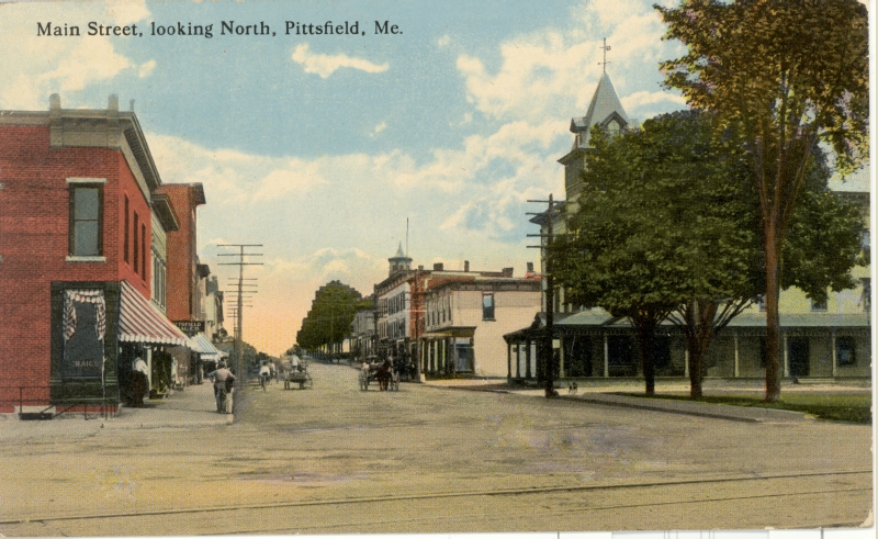
Views of Downtown
Click on pictures to enlarge.
Looking Downhill. | Looking Uphill from RR tracks | Individual buildings
If you are looking for a business or a house on a street,
see the Past Businesses page
or the Historic Houses page. |
LOOKING DOWNHILL
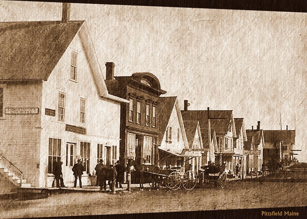
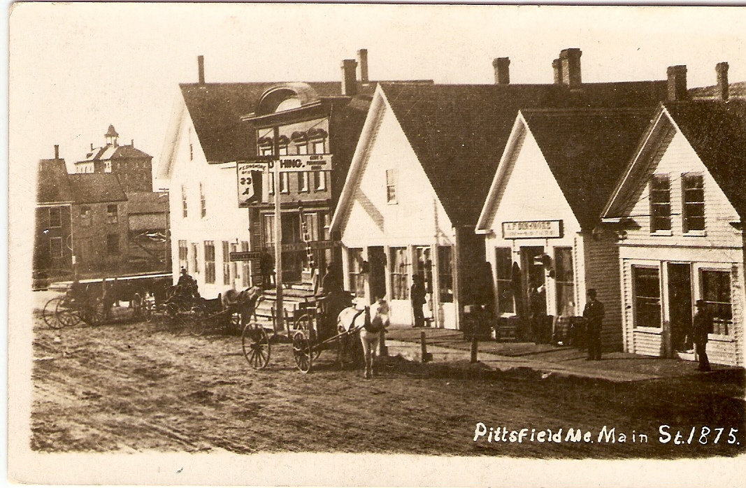
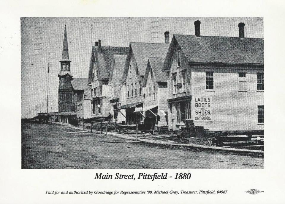
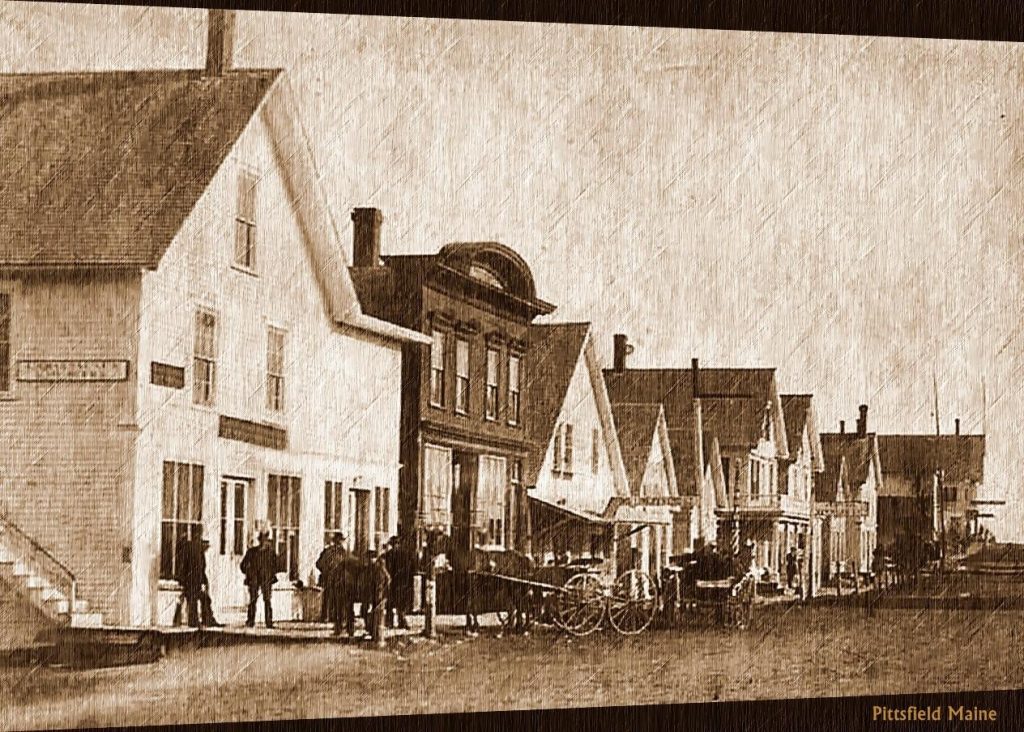
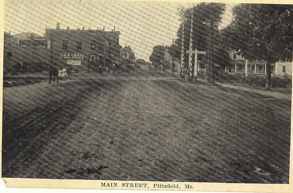
Two renditions of an 1875 photo of the south end of the west side of Main Street, at the corner of Central Street. Founders Hall at MCI is in the background on left.
|
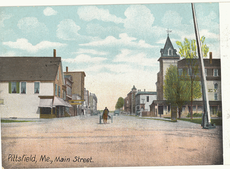
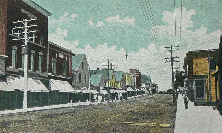
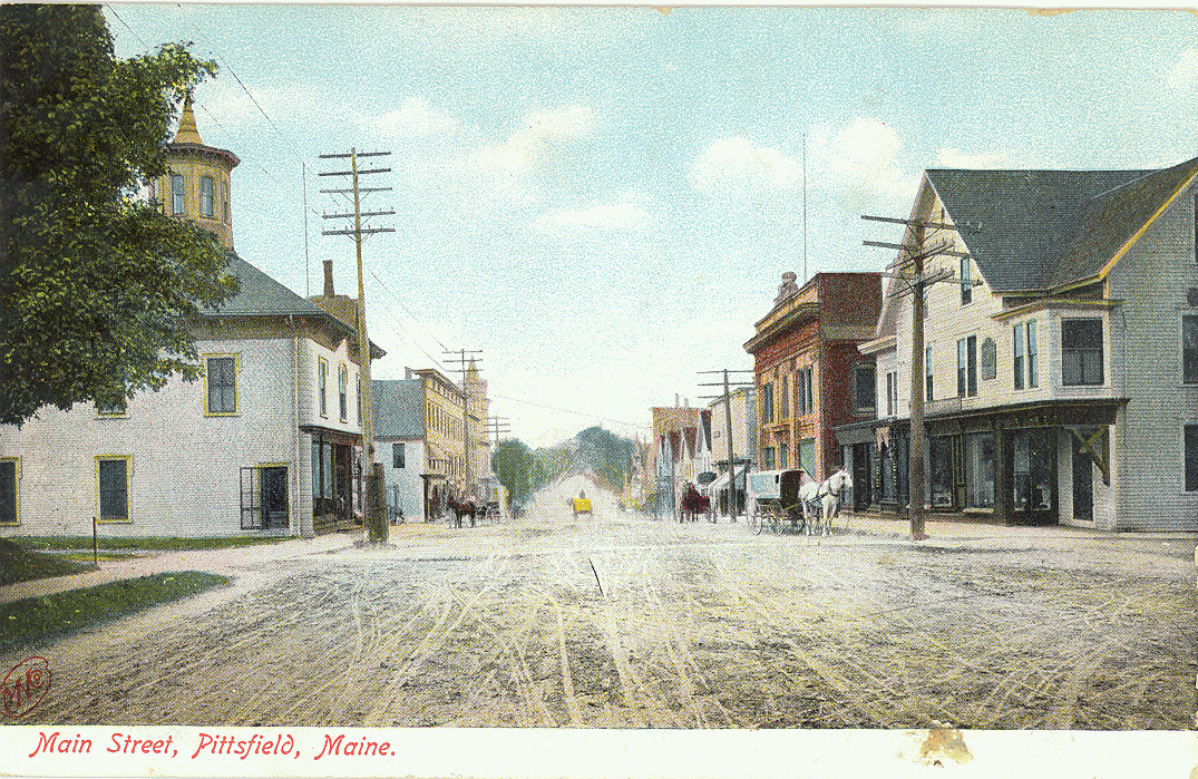 Main Street looking south, viewed from middle of intersection with Park Street, circa 1890 colorized postcard. Note current Merrill Bank building on right. Same colorized image, cropped, below. Main Street looking south, viewed from middle of intersection with Park Street, circa 1890 colorized postcard. Note current Merrill Bank building on right. Same colorized image, cropped, below.
|
 |
 Main Street looking south viewed from center of intersection with Park Street, c.1920 photo. Main Street looking south viewed from center of intersection with Park Street, c.1920 photo. |
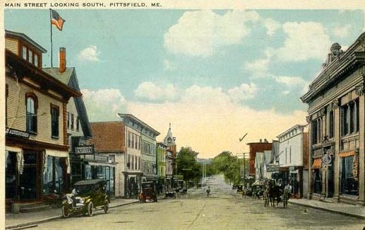 View of Main Street looking south viewed from just above current Merrill Bank Building, late 1930’s colorized postcard. View of Main Street looking south viewed from just above current Merrill Bank Building, late 1930’s colorized postcard.
|
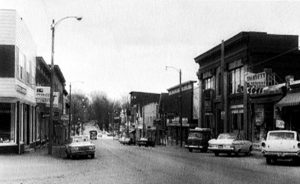 Main Street looking down hill circa 1960. |
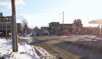 Intersection of Main Street and Park Street viewed from Gulf Station, 2005 photo. Intersection of Main Street and Park Street viewed from Gulf Station, 2005 photo.
|
LOOKING UPHILL
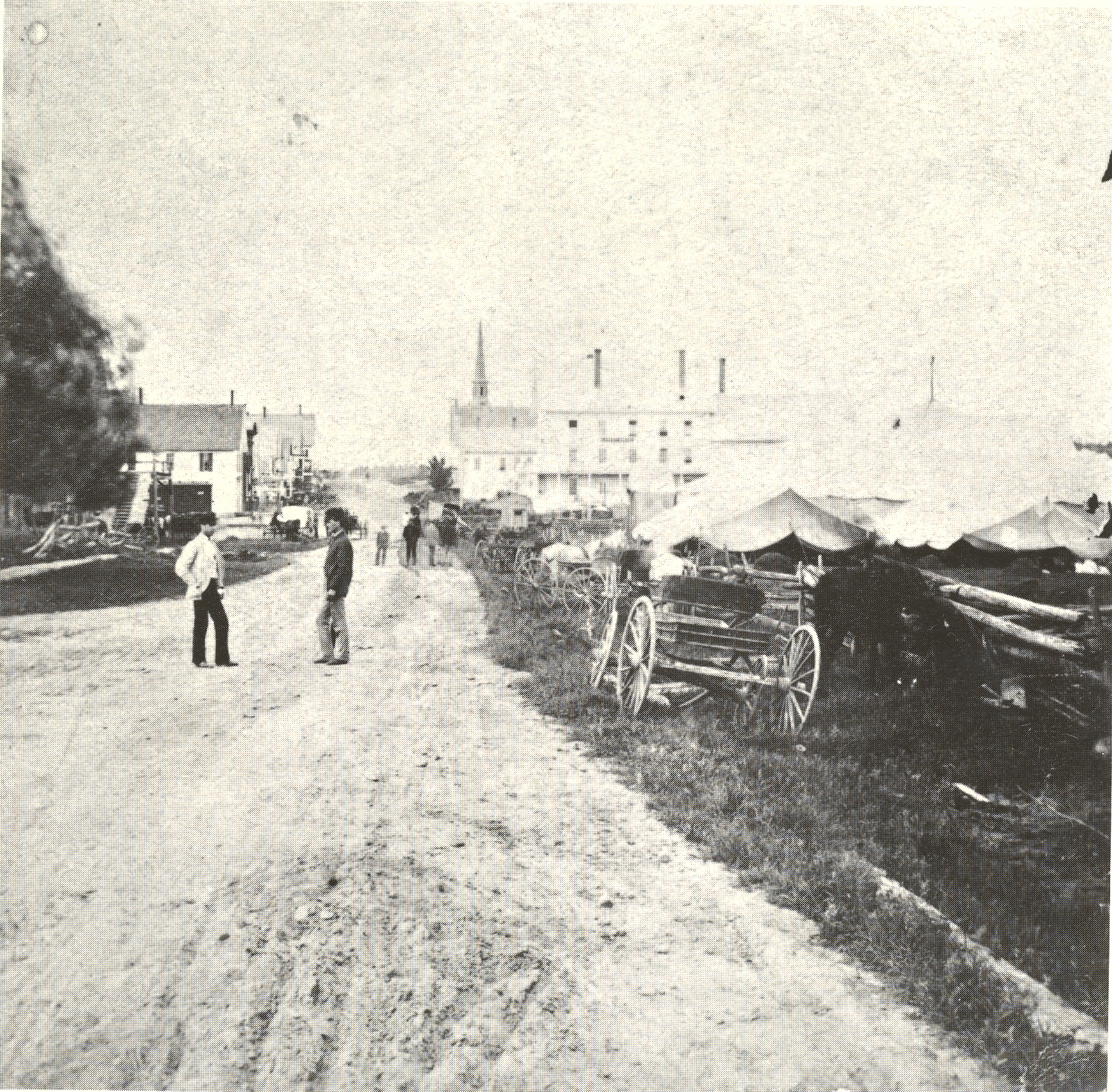 Main Street looking north from near current location of library. Photo from 1866-1870 era, oldest known photo of Pittsfield. Note Lancey House, beyond wagons, showing porch and early peaked roof design. Later the roof was changed to a hip roof design. Beyond the Lancey House the Union Meeting House is visible; it later became the Universalist Church. Main Street looking north from near current location of library. Photo from 1866-1870 era, oldest known photo of Pittsfield. Note Lancey House, beyond wagons, showing porch and early peaked roof design. Later the roof was changed to a hip roof design. Beyond the Lancey House the Union Meeting House is visible; it later became the Universalist Church.
|
|
 Downtown scene from the late 1800s. |
 Main Street looking north viewed from just below RR tracks, circa 1890 colorized postcard. Note that Lancey House now has hip roof, allowing windows in the rooms on the third floor. Main Street looking north viewed from just below RR tracks, circa 1890 colorized postcard. Note that Lancey House now has hip roof, allowing windows in the rooms on the third floor.
|
 Main Street looking north from the RR tracks, a decade or so after the previous image. Note wooden building on left in previous image is now brick, the trees beside the Lancey House are larger, and utility poles have been installed. Main Street looking north from the RR tracks, a decade or so after the previous image. Note wooden building on left in previous image is now brick, the trees beside the Lancey House are larger, and utility poles have been installed.
|
 Main Street looking North viewed from just below RR tracks. Note Lancey House on right, through trees. c.1920. Main Street looking North viewed from just below RR tracks. Note Lancey House on right, through trees. c.1920.
|
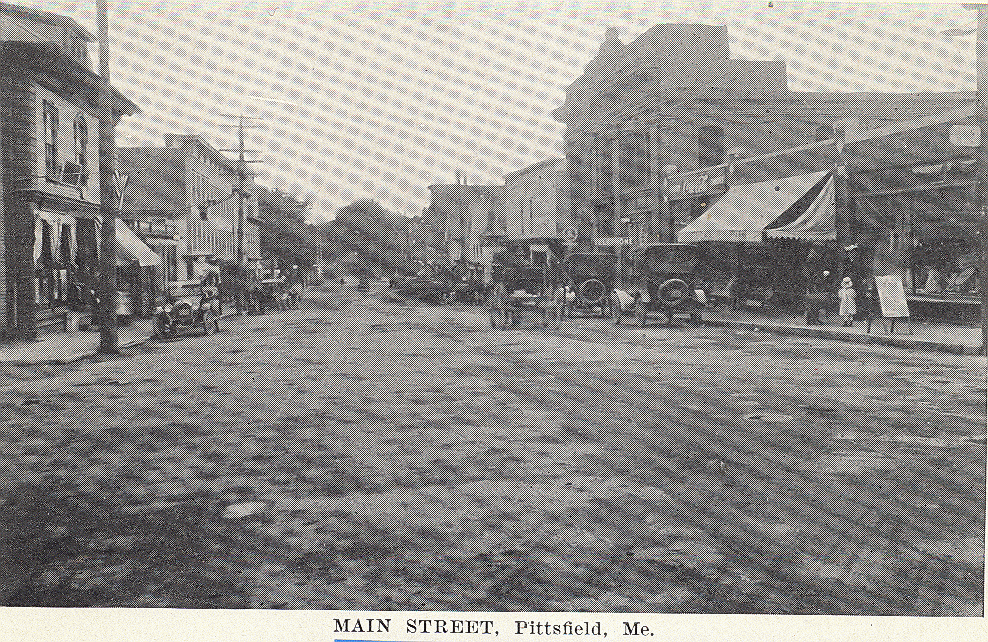
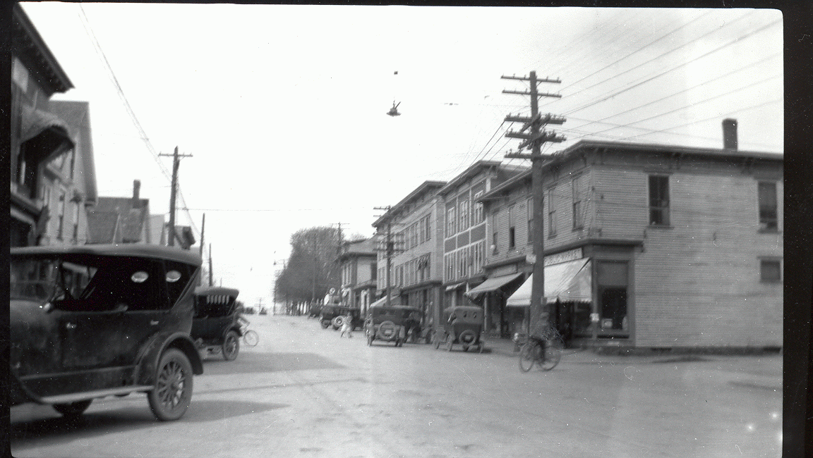 A 1935 photo of Main Street just after being paved for the first time. The “Public Market” became the A&P. The entire block from Hunnewell Ave. to Easy Street was razed in the 1974 renewal; the Cianbro building and parking lot is in this spot now. A 1935 photo of Main Street just after being paved for the first time. The “Public Market” became the A&P. The entire block from Hunnewell Ave. to Easy Street was razed in the 1974 renewal; the Cianbro building and parking lot is in this spot now.
|
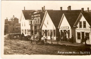
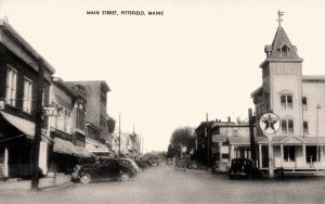
 The Perkins and Vickery blocks from circa 1908. Note wooden crosswalk embedded in the gravel street. The Perkins and Vickery blocks from circa 1908. Note wooden crosswalk embedded in the gravel street.
|
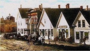
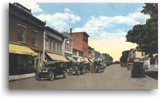 Similar view as above, around the 1930’s, from colorized post card from Town of Pittsfield website. Similar view as above, around the 1930’s, from colorized post card from Town of Pittsfield website.
|
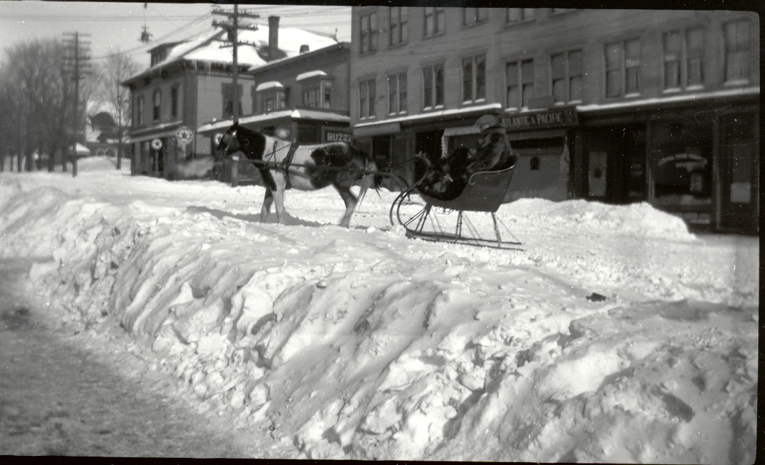 A sleigh on Main Street, showing east side of Main Street. Note how half the street was plowed for wheeled vehicles, half left unplowed for sleighs. A sleigh on Main Street, showing east side of Main Street. Note how half the street was plowed for wheeled vehicles, half left unplowed for sleighs.
|
|
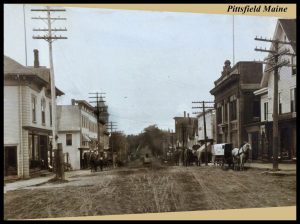
 Looking uphill from the RR tracks, circa 1950. Looking uphill from the RR tracks, circa 1950.
|
|
DOWNTOWN BUILDINGS

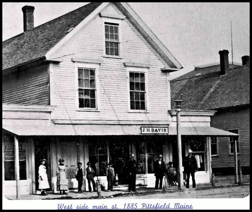
Humphrey’s Drug Store and Cornforth’s Clothing Store, on the west side of Main St., where bank drive-thru is now.
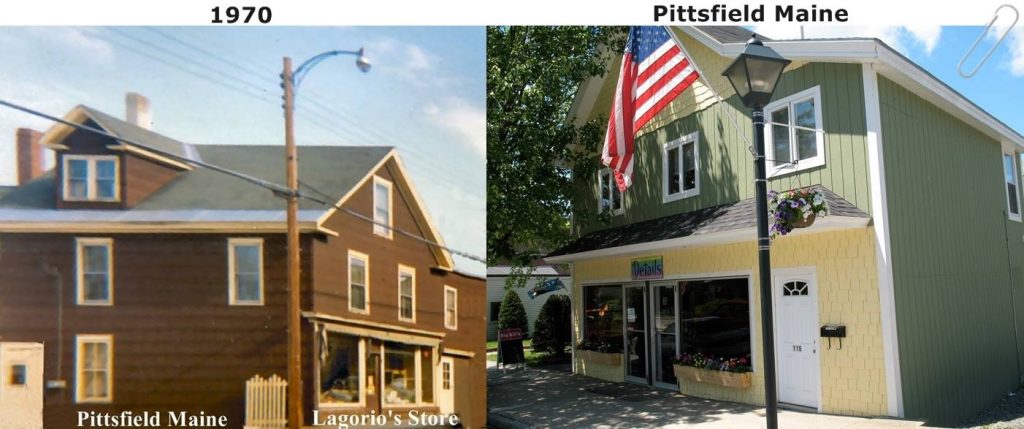
Legorio’s Store in 1970; same building in early 2000s viewed from the opposite angle.
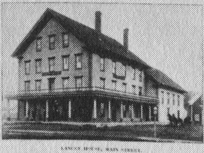
Lancey House in 1880 before hip roof and tower were installed. Located at southeast corner of Hunnewell and Main.

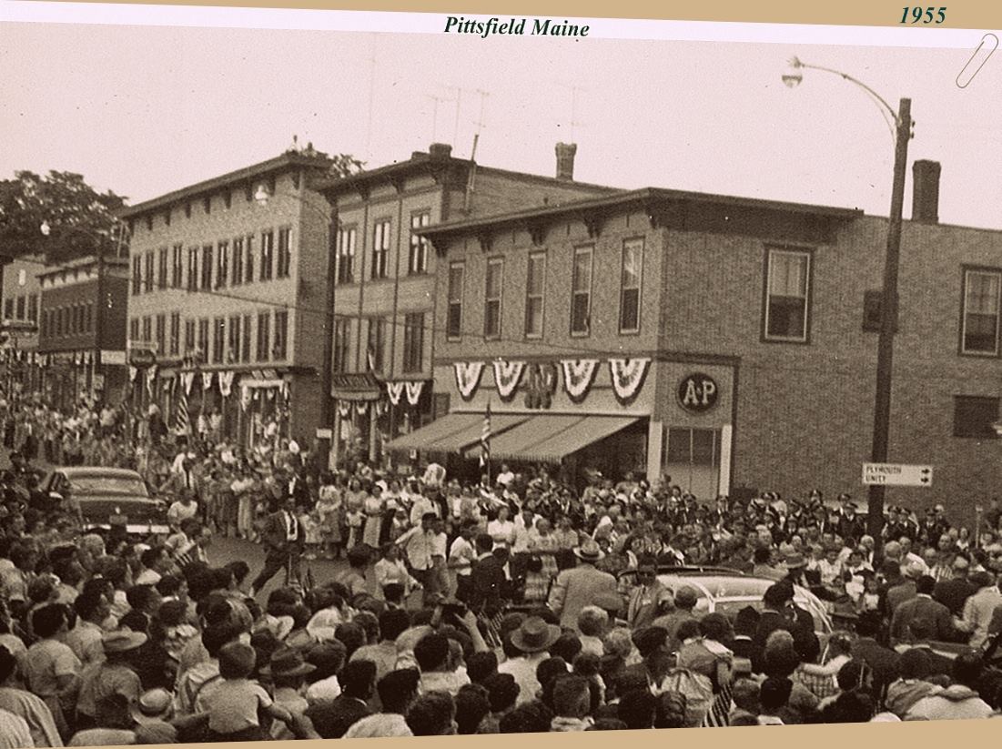
A&P on the east side of Main St, at the corner of Hunnewell Ave., in 1955.
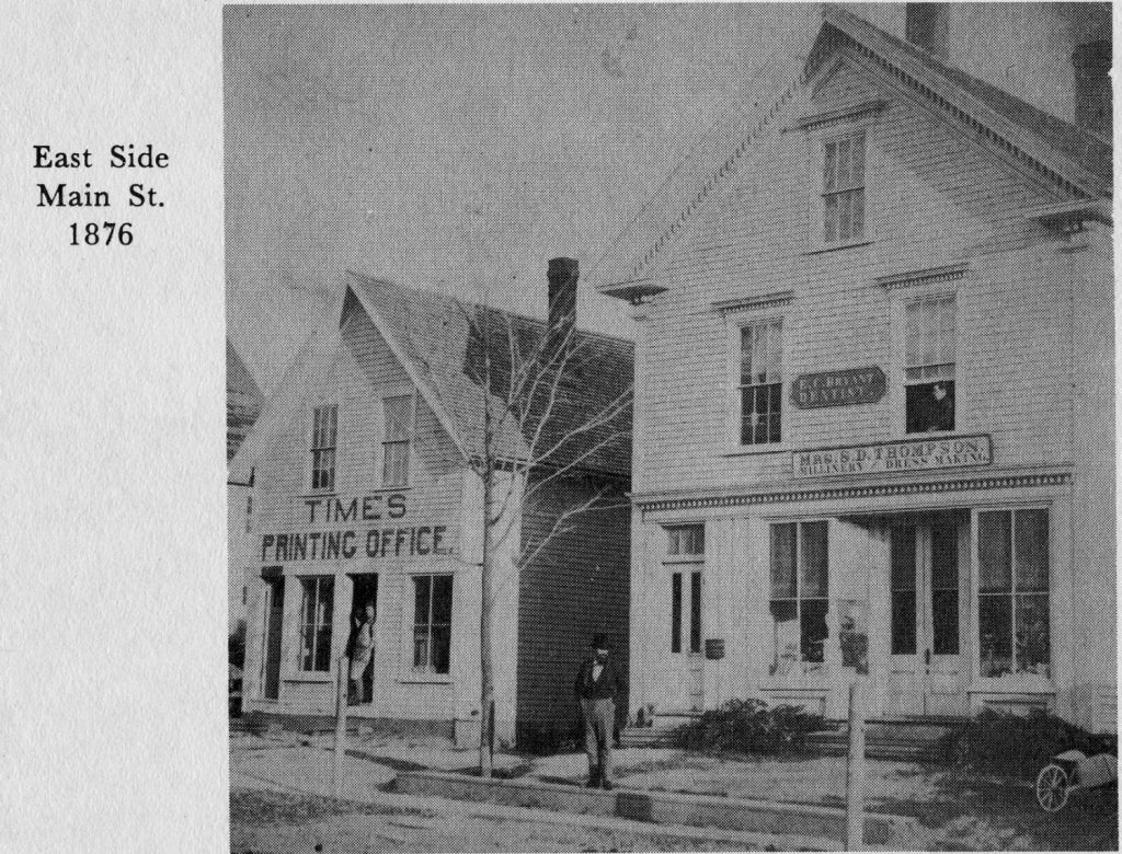
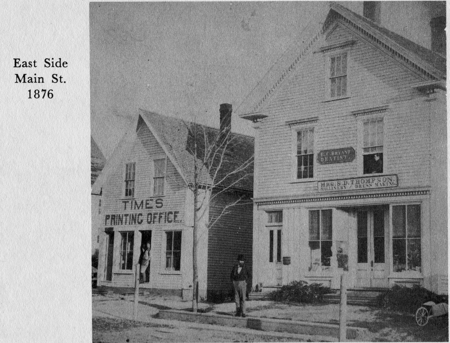
The Times printing office next to Mrs. S.D. Thompson Millinery with Dr E.C.Bryant, dentist, upstairs.
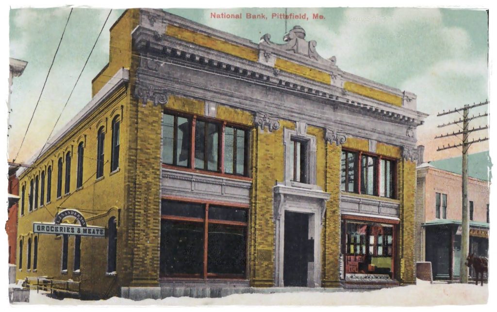
Pittsfield National Bank building with L.J.Sandersons Groceries and Meats in basement via side entrance. Later became Merrill Bank; today is People’s United Bank.